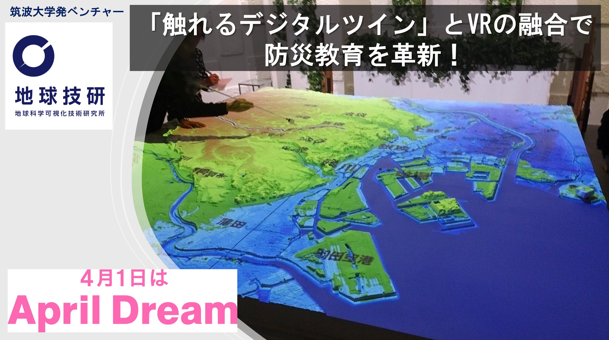
Tsukuba University Venture 'Institute of Earth Science Visualization Technology Inc.' Accelerates Innovation in Disaster Prevention Education with 'Tangible Digital Twin' Merged with VR Technology
Tsukuba University venture promotes disaster prevention education and regional issue resolution with 'Tangible Digital Twin'.
📋 Article Processing Timeline
- 📰 Published: April 1, 2026 at 09:00
- 🔍 Collected: April 1, 2026 at 01:00
- 🤖 AI Analyzed: April 16, 2026 at 10:39 (369h 38m after Collected)
We support April Dream, an initiative to make April 1st a day to share dreams. This press release is the dream of "Institute of Earth Science Visualization Technology Inc.".
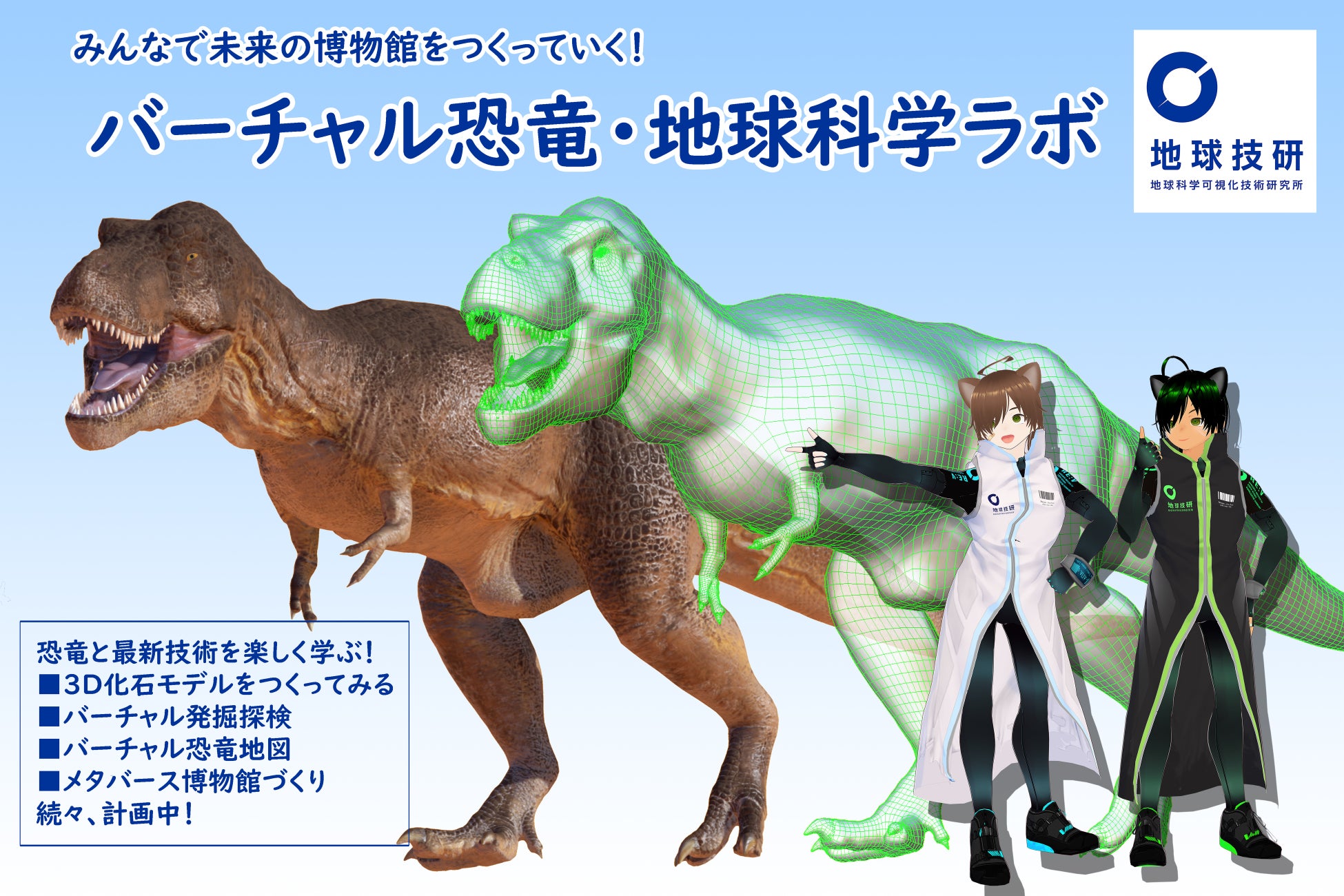
Institute of Earth Science Visualization Technology Inc. (Headquarters: Tsukuba City, Ibaraki Prefecture https://www.revj46.com/), a venture originating from the University of Tsukuba, visualizes earth information, such as topography and geology, as a 'Tangible Digital Twin' through its unique 3D modeling and projection mapping technology. We will propose solutions for regional issues and strongly support regional future strategies.

(1) Our Dream: Making the Invisible Earth 'Personal'
Beneath our feet lie geological strata accumulated over hundreds of millions of years, complex underground water flows, and faults that can sometimes unleash their fury. Because these are usually 'invisible,' it is difficult for us to truly grasp the risks of disasters. However, research institutions and universities have accumulated a wealth of survey data on these risks. We have commercialized this survey data into a 'Tangible Digital Twin' by integrating the latest digital technology with physical models, and have deployed it in numerous universities and museums.
As a venture originating from the University of Tsukuba, our dream is to deliver these products and information not just to museums, but to people in their daily lives. This will enable intuitive understanding of earth data and blueprints that were previously only decipherable by experts, fostering a society where everyone can make safety choices based on their own judgment. Disaster prevention challenges vary by region, including volcanoes, floods, and earthquakes. We will propose detailed visualization processes tailored to these needs and aligned with regional future strategies.
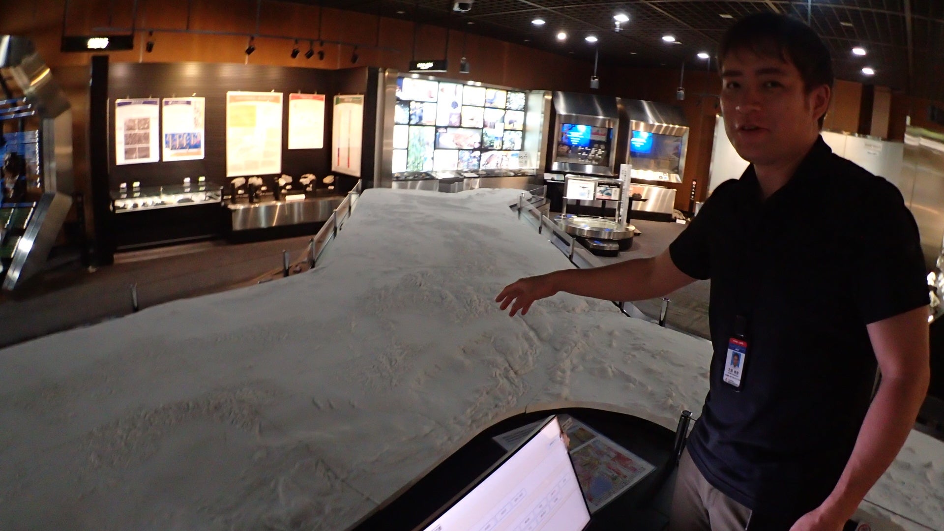
Before Projection Mapping
10m Precision Model in White

After Projection Mapping
Diverse information such as topography and road networks is projected.
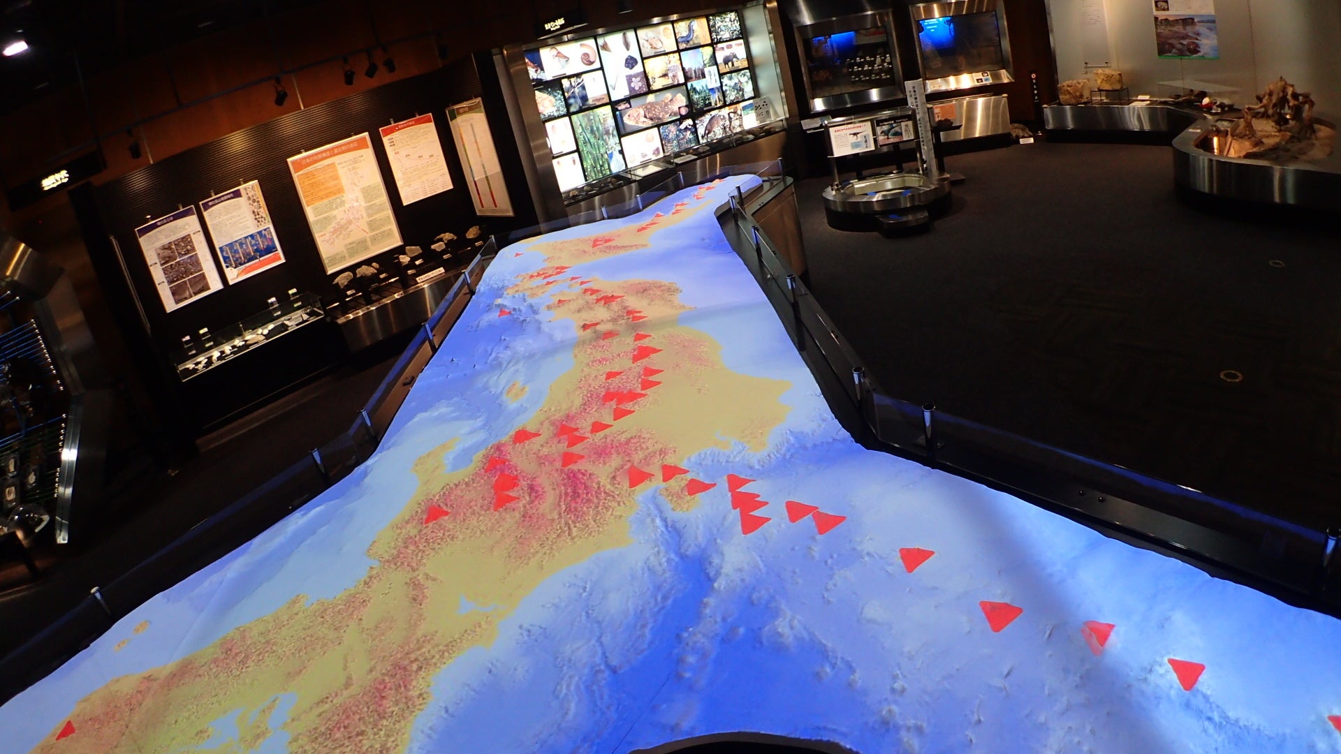
Disaster Prevention Information
Active volcanoes, active fault locations, and human flow data can be multi-projected.

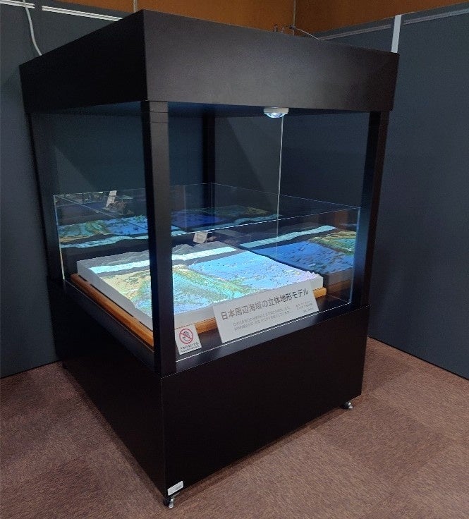
Operation Panel
Over 100 types of data can be projected (all photographed on the 1st floor of the Geological Museum).
(2) Next-Generation Business for Our Dream: Integrated Experience with 'Tangible Digital Twin' x 'VR'
Based on our proprietary patented technologies (Patent Nos. 6079990, 6176660), we possess the technology to rapidly and precisely materialize surface and underground structures using projection mapping and 3D models. By combining this with VR/XR technology, we will roll out next-generation businesses nationwide, including the following:
- 4D Hazard Map Experienced with All Senses:
We will project disaster simulations onto precise topographical models using projection mapping and simultaneously offer an immersive VR experience of being in the midst of the disaster. We are building a platform that allows for an understanding of 'where, why, and how it is dangerous' through all senses, moving beyond mere symbolic hazard maps.
- Educational Platform for Walking Through 'Earth's Memories':
We will provide a system for museums and schools where users can touch models and observe reconstructions of terrain and ancient creatures from tens of thousands of years ago in VR. This platform will transform earth science from 'memorization' to 'exploration,' fostering children's scientific curiosity. In this way, Institute of Earth Science Visualization Technology Inc. aims to revolutionize future disaster prevention education through technological innovation.
(3) Our Journey Towards Realizing Our Dream
As a venture originating from the University of Tsukuba, we have pursued the visualization of earth science in collaboration with national research institutions and museums. This has led to our selection in Toyo Keizai's '100 Amazing Ventures (Latest 2025 Edition)'. Furthermore, we have formed an alliance with major telecommunications and video companies, signing a cooperation agreement with IMAGICA EEX (https://eex.co.jp/2025/10/revj_alliance/). Together with NTT QONOQ, we have supervised AR content 'LOST ANIMAL PLANET' which revives extinct creatures, and have also developed our own VR museums.
Leveraging this experience, we will provide more interactive experiences by converting our accumulated earth science data into VR and combining it with existing projection mapping.
(4) Conclusion: Dialogue with the Earth, Preparing for the Future
As an example of our regional future strategy assistance, our 3D data and geological information were featured in the February issue of JR East's in-train magazine 'Trans-verse' (https://www.jreast.co.jp/railway/trainvert/digitalbook/tr2602/index.html). In this issue, our representative, Akihiko Shibahara, explained using 3D geological data why many Japanese visual works, including the 'Ultraman Series' celebrating its 60th anniversary, are filmed in Tochigi Prefecture. We encourage you to take a look.
Understanding the Earth means understanding the future. The 'Tangible Digital Twin' we propose is an endeavor to transform specialized data into a 'common language' accessible to everyone. In 2026, we will evolve this technology into a cornerstone of disaster prevention learning and regional future strategies, increasing places worldwide where people can engage in dialogue with the 'heart of the Earth.'
■Institute of Earth Science Visualization Technology Inc.
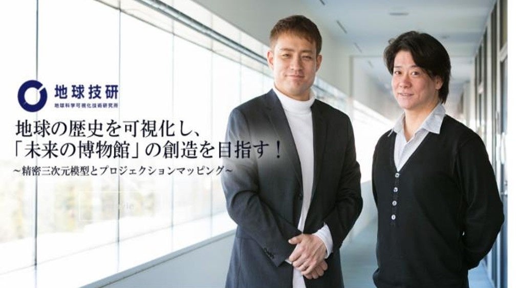
Representative: Akihiko Shibahara
Paleontologist. Ph.D. (Science). Specializes in Earth science and 3D modeling/VR. Author and supervisor of over 20 books and works on earth science and dinosaurs. Developed patents related to earth science visualization. Extensive media experience, including scientific consulting for the 'Ultraman Series'.
Deputy Representative: Satoru Daidouji
Representative of Nishimura Precision Topographical Models / CTO of Institute of Earth Science Visualization Technology Inc. / Owner of Map Bar M@Akasaka. Planning Committee Member, The Cartographic Society of Japan / Deputy Chief, Outreach Committee, The Cartographic Society of Japan / Supporting Member, Association of Japanese Geographers.
FAQ
What is a 'Tangible Digital Twin'?
It is a technology that visualizes earth information such as topography and geology as a tangible physical model using proprietary 3D modeling and projection mapping technology. This allows for intuitive understanding of the risks of the unseen earth and the past appearance of the planet.
What kind of educational experiences become possible by integrating VR technology?
By combining with VR technology, we offer a '4D Hazard Map' where users can experience disaster simulations projected onto precise topographical models as if they were there, and an 'Educational Platform for Walking Through Earth's Memories' where users can recreate and observe terrain and ancient creatures from tens of thousands of years ago in VR.
What kind of regional issues can you help solve?
We support the promotion of disaster prevention education tailored to regional characteristics and the formulation of regional future strategies based on topographical and geological data. For example, we can visualize risks of volcanoes, earthquakes, and floods, contributing to raising residents' disaster awareness and assessing risks in regional development.
What are the company's strengths?
As a venture originating from the University of Tsukuba, our strengths lie in our unique visualization technology that fuses expertise in earth science with proprietary patented technologies in 3D modeling, projection mapping, and VR. Our track record of collaboration with national research institutions and museums, as well as alliances with major companies, are also key strengths.