University of Tsukuba Startup "Research Institute of Earth Science Visualization Technology Co., Ltd." Accelerates Innovation in Disaster Prevention Education with 'Touchable Digital Twin' Fused with VR Technology
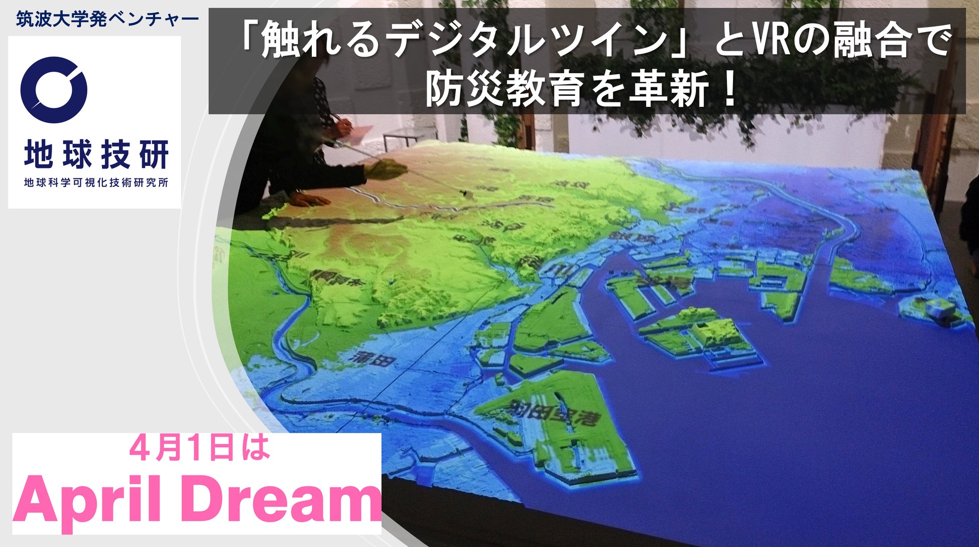
The "Research Institute of Earth Science Visualization Technology," a startup from the University of Tsukuba, has developed a "Touchable Digital Twin" that merges proprietary 3D modeling and projection mapping. It aims to revolutionize disaster prevention education and regional future strategies by intuitively visualizing unseen geological strata and disaster risks.
📋 Article Processing Timeline
- 📰 Published: April 1, 2026 at 09:00
- 🔍 Collected: April 1, 2026 at 01:00
- 🤖 AI Analyzed: April 22, 2026 at 20:10 (523h 9m after Collected)
We endorse April Dream, a project to make April 1st a day for sharing dreams. This press release is the dream of the "Research Institute of Earth Science Visualization Technology Co., Ltd."
The University of Tsukuba startup "Research Institute of Earth Science Visualization Technology Co., Ltd." (Headquarters: Tsukuba City, Ibaraki Prefecture https://www.revj46.com/) visualizes earth information, namely terrain and geological data, as a "Touchable Digital Twin" through its unique 3D modeling and projection mapping. We propose solutions to regional issues and strongly assist in regional future strategies.

(1) Our Dream: Making the Unseen Earth a "Personal Matter"
Beneath our feet lie geological strata accumulated over hundreds of millions of years, complexly flowing groundwater, and sometimes, faults that bare their fangs. Because these are normally "invisible," it is difficult for us to truly feel the risk of disaster. However, research institutions and universities have accumulated a wealth of survey data on these risks. We have been commercializing this survey data as a "Touchable Digital Twin," a fusion of the latest digital technology and physical models, and have deployed them in numerous universities and museums.
As a startup from the University of Tsukuba, our dream is not just to keep these products and information in museums, but to bring them closer to everyone. This will enable anyone to intuitively understand earth data and drawings that were previously decipherable only by experts, and to build a society where everyone can choose safety based on their own judgment. The challenges related to disaster prevention vary by region, such as volcanoes, floods, and earthquakes. We will cater to these needs and propose detailed visualization processes in line with regional future strategies.