Mapry Releases Major Version Upgrade for Low-Cost, High-Precision, Multi-function LiDAR Scanner "mapry LA03-1"
Mapry has significantly upgraded its LiDAR scanner "mapry LA03-1", doubling continuous measurement time, introducing a 2WAY specification, real-time point cloud display, and high-precision positioning via GNSS linkage. Priced at 397,000 JPY (excluding tax), it dramatically improves work efficiency.
📋 Article Processing Timeline
- 📰 Published: April 10, 2026 at 18:20
- 🔍 Collected: April 11, 2026 at 00:29 (6h 9m after Published)
- 🤖 AI Analyzed: April 20, 2026 at 00:51 (216h 22m after Collected)
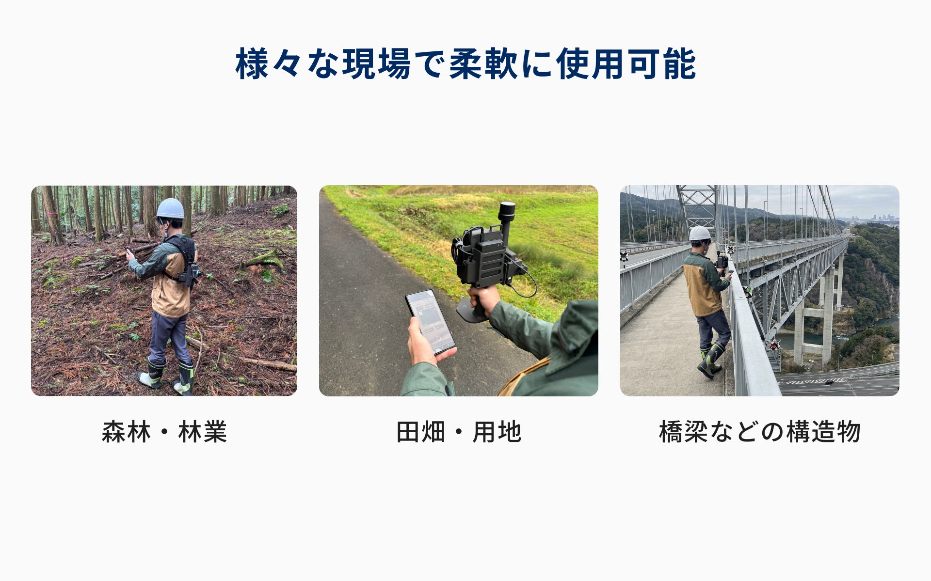
Mapry Co., Ltd. (Headquarters: Tamba City, Hyogo Prefecture, Representative Director: Keiji Yamaguchi, hereinafter referred to as Mapry), the provider of the geospatial information app platform "mapry", will renew its LiDAR scanner "mapry LA03-1", widely used in forestry, civil engineering, and surveying fields, on April 10, 2026 (Friday), and begin offering a new model with significantly enhanced functions.
The new model has significantly extended the continuous measurement time from the previous 30 minutes to 1 hour. It is now possible to scan a wide area at once without interrupting work for battery replacement, dramatically improving work efficiency on site.
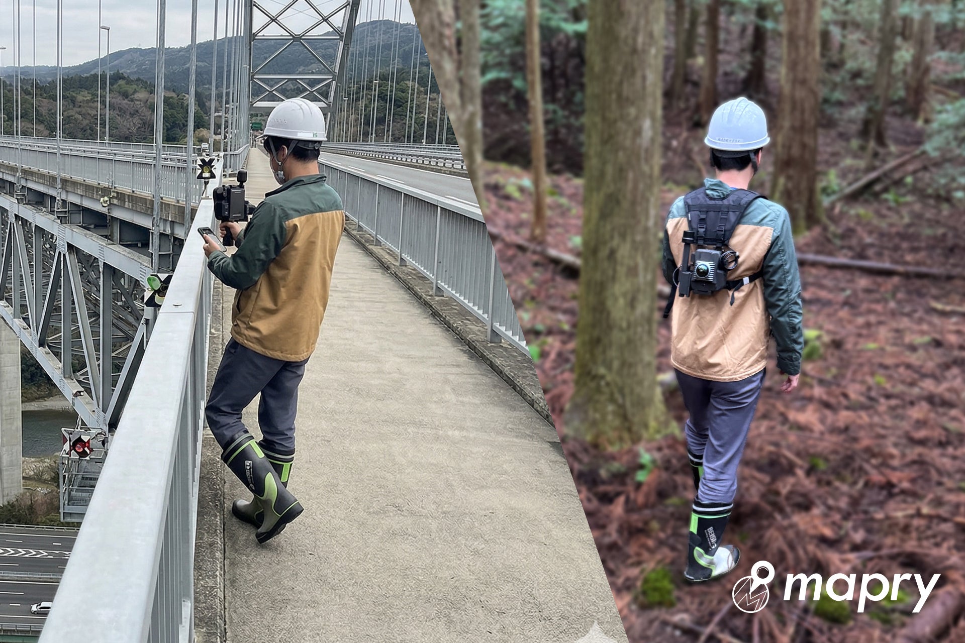
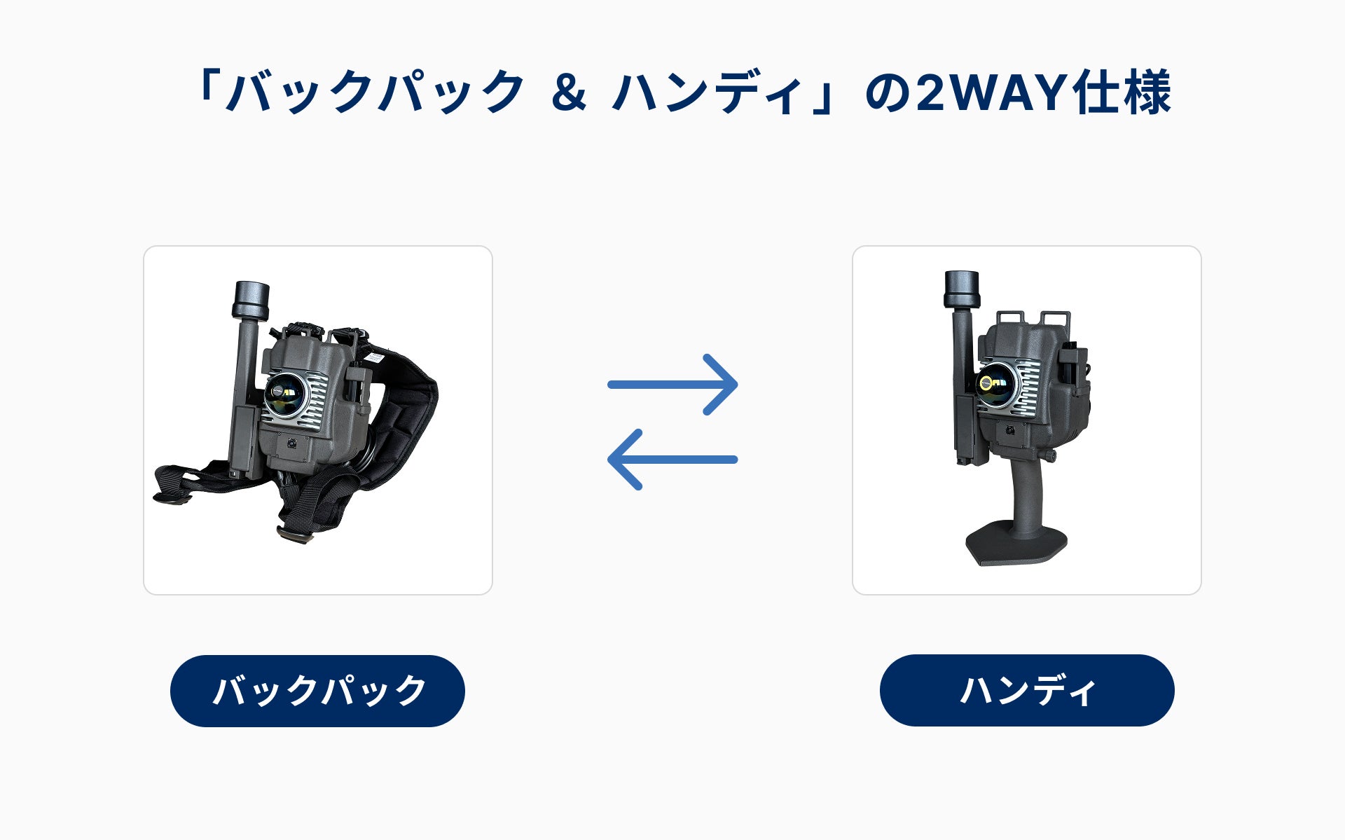
Furthermore, it has evolved into a "2WAY specification" that can be used as a handheld type in addition to the conventional backpack operation. It also newly supports "real-time point cloud display during measurement", which was a frequent request from the field, and "high-precision positioning by GNSS receiver linkage". The selling price is 397,000 yen (excluding tax), achieving high functionality while maintaining its previous ease of use.
Main improvements in the new "mapry LA03-1"
The new model features significant expansion and improvements to the following functions compared to the previous model (LA03):
1. "Backpack & Handy" 2WAY specification selectable by application
While previously backpack-exclusive, the new model allows free switching between "backpack" and "handy" according to the site environment and application. Flexible operation is possible, such as using the backpack for vast forests and the handy unit for complex sites or localized scanning.
2. High-precision point cloud generation through GNSS receiver linkage (new function)
It now supports connection with our GNSS receivers "mapry R1" and "mapry R2". By combining scan data with high-precision positional information, it is possible to generate point cloud data with an accuracy of 50mm.