JICA 與秘魯文化部及福島縣的 Futaba 公司合作,利用日本高精度 3D 測量技術(無人機光達技術)進行調查,成功從馬丘比丘遺跡周邊的茂密叢林下,提取出過去難以確認的多處新遺構形狀。此成果是一項劃時代的舉措,實現了在不砍伐森林的情況下確認未勘查區域的遺跡,是 JICA 在提升文化遺產保護和加強旅遊安全方面合作的一大步。本次調查是 JICA 事業的一部分,旨在運用日本的技術和知識,應對秘魯在提升文化遺產保護與旅遊兼顧的國家級挑戰。
本次調查中,在馬丘比丘遺跡東北部廣闊的大型梯田群「Andenes Orientales」中,首次成功掌握了因被樹木覆蓋而難以辨識的全貌。此外,在遺跡北側未調查區域的月神殿附近,新確認了多處具有特徵的遺構候補,包括一個 L 形的牆狀結構(高約 2.7 公尺)、對稱排列的三段式梯田,以及可能經過加工的長方體石材等。這些發現是透過從無人機光達技術獲取的高密度點雲數據中去除森林部分數據,非破壞性地提取地表地形而得以實現的。
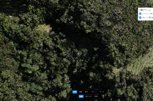
Andenes Orientales 的梯田:位於馬丘比丘遺跡北側至東側基地的遺跡 Andenes Orientales。照片中被樹木覆蓋而無法確認的梯田,透過點雲化並去除樹木等不需要的數據,確認了整個梯田的規模及其與鄰近梯田的連接位置。
常見問題
What new discoveries were made around Machu Picchu?
Multiple new structures and features, including an L-shaped wall, symmetrical terraces, and processed stones, were identified under the jungle surrounding Machu Picchu, particularly in the 'Andenes Orientales' area and near the Temple of the Moon.
What technology was used for this discovery?
The discovery was made using advanced Japanese 3D surveying technology called UAV-LiDAR (Unmanned Aerial Vehicle - Light Detection and Ranging). This technology allows for high-precision 3D mapping.
How does UAV-LiDAR technology help in discovering ruins?
UAV-LiDAR uses lasers to create a detailed 3D map of the terrain. By processing the data to remove vegetation, it can reveal ground surface features and structures that are hidden beneath dense forests without the need for physical excavation or deforestation.
What is the significance of these findings?
These findings are significant because they enable the identification of previously unknown ruins in unexplored areas without damaging the environment. This contributes to better cultural heritage preservation and can enhance tourism safety and planning around Machu Picchu.
Who was involved in this project?
The project involved JICA (Japan International Cooperation Agency), the Peruvian Ministry of Culture, and Futaba Corporation, a company from Fukushima Prefecture, Japan.