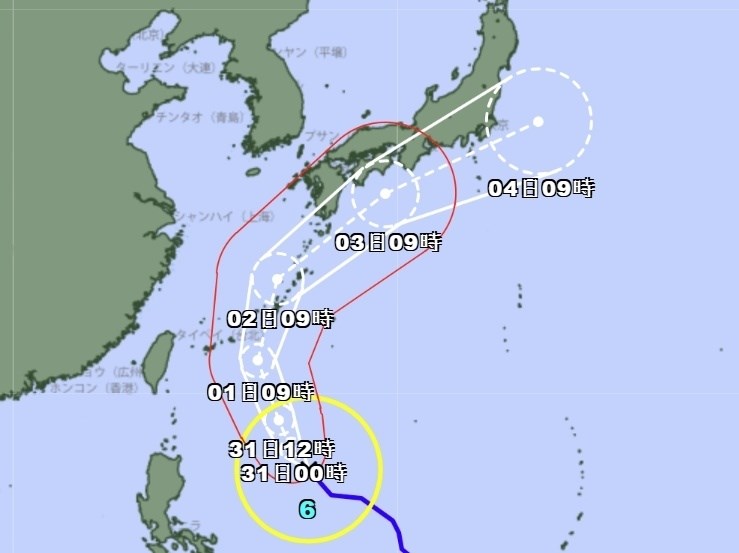
The Japan Meteorological Agency (JMA) predicts that the storm zone of this year's Typhoon No. 6, Jangmi, may approach the Okinawa and Amami regions around June 1st to 2nd, and then move closer to the Kyushu, Shikoku, and Kinki regions around June 3rd. According to the typhoon path forecast map released by the JMA at 9:45 AM today, as of 9:00 AM, Jangmi was located in the waters east of the Philippines, with a central pressure of 992 hPa, a maximum sustained wind speed of 23 meters per second, and a maximum instantaneous wind speed of 35 meters per second. NHK reports that the JMA expects the typhoon to continue moving north while strengthening, bringing strong winds and rain to Okinawa and Amami by the 1st or 2nd. Giant waves and warning-level heavy rain are expected. The typhoon is then expected to continue north, approaching Kyushu, Shikoku, and Kinki by June 3rd, and potentially moving closer to the Tokai and Kanto-Koshin regions. Heavy rain may occur in these areas even before the typhoon arrives.
FACT BOX
- Source: CNA (Central News Agency)
- Category: weather
- Organizations: NHK