CFD Co., Ltd. (President: Koji Mitani, Headquarters: Nagoya City, Aichi Prefecture), the general distributor in Japan, announces that QYSEA has launched the next-generation inertial navigation system for underwater drones, 'U-INS Plus'.
Autonomous navigation and route planning functions, which are commonplace for aerial drones, are now realized underwater.
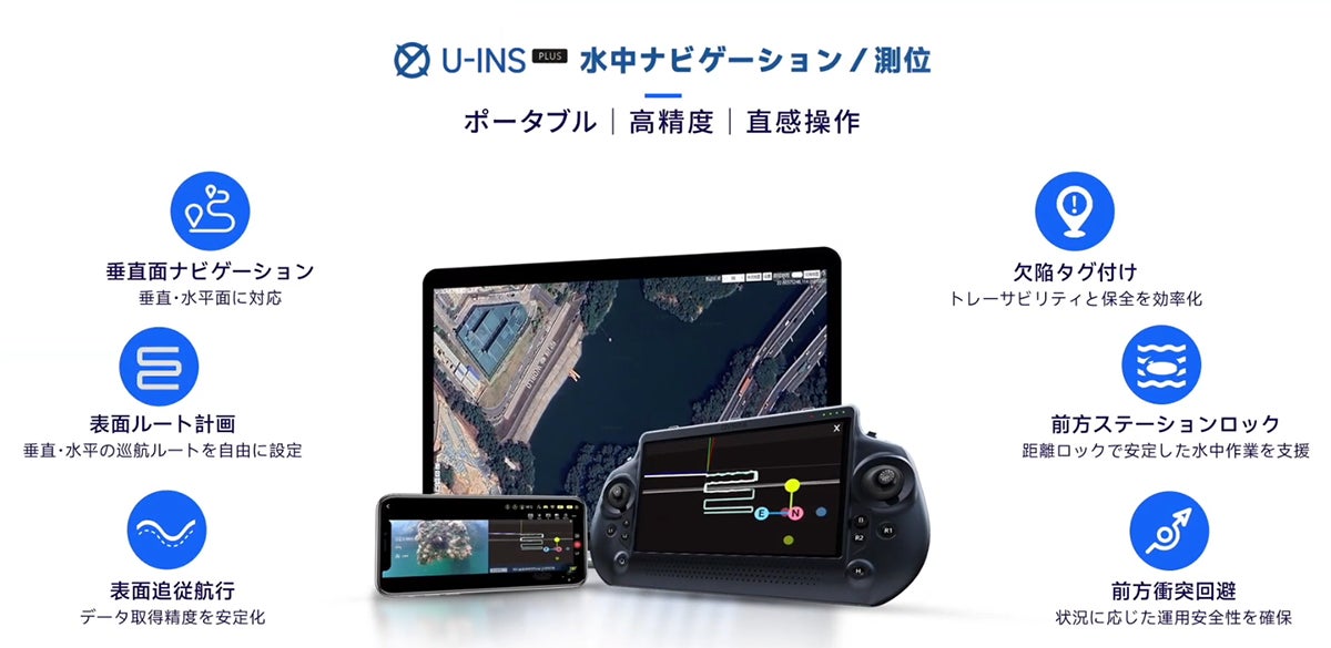
QYSEA, which pioneered the practical application of autonomous navigation on the seabed plane in 2024 with its proprietary Q-DVL (Acoustic Doppler Velocity Log) and sensor fusion technology, has evolved this system over approximately one year into 'U-INS Plus', which supports autonomous navigation not only on horizontal planes but also on vertical planes.
By combining satellite positioning with sensors, high-precision navigation is possible even underwater. This enables autonomous travel not only horizontally but also vertically, and allows for maintaining distance from irregular wall surfaces.
The sensor module compatible with U-INS PLUS features a modular design that can be applied to multiple QYSEA FIFISH series models.
For detailed information on features and compatibility, please refer to CFD Sales' press releases or contact our representative via the inquiry page.
Combining Satellite Positioning and Sensors Enables High-Precision Navigation Underwater On the water surface, absolute coordinates are obtained via GNSS satellite positioning. After diving, the Q-DVL and IMU sensors continuously estimate and correct the position in real-time. High-precision navigation is now possible even underwater where GNSS signals cannot reach. View Details
Smooth Inspections with Minimal Crew Possible with 5-Minute Setup The lightweight and portable underwater drone 'QYSEA FIFISH' series is
FACT BOX
- Source: PR TIMES
- Category: News